Re-designing Rivers
With this project, we set out to exhibit some of the drawings from fieldwork experiences around counter-mapping in Ecuador, which expose local territorial understandings and represent the act of drawing as a political design project.
How to make local identities, knowledge and power struggles visible?
The use of counter-mapping is becoming a political tool to understand struggles, conflicts, identities and sense of place in different territories within a larger research-by-design framework. This framework aims to investigate complex territories and translate them into understandable drawings that different audiences can relate to and easily understand. Furthermore, the knowledge translated into the map comes from the communities themselves to communicate their own needs and understandings of their territory, giving them the opportunity to visualize their own understandings to develop place-based design solutions.
Worldwide, management of rivers and riverine landscapes is commonly based on the top-down processes of landscape design and territorial planning. These processes directly affect riverine communities and livelihoods, triggering local confrontations with the imposed designs and related forms of socio-material ordering.
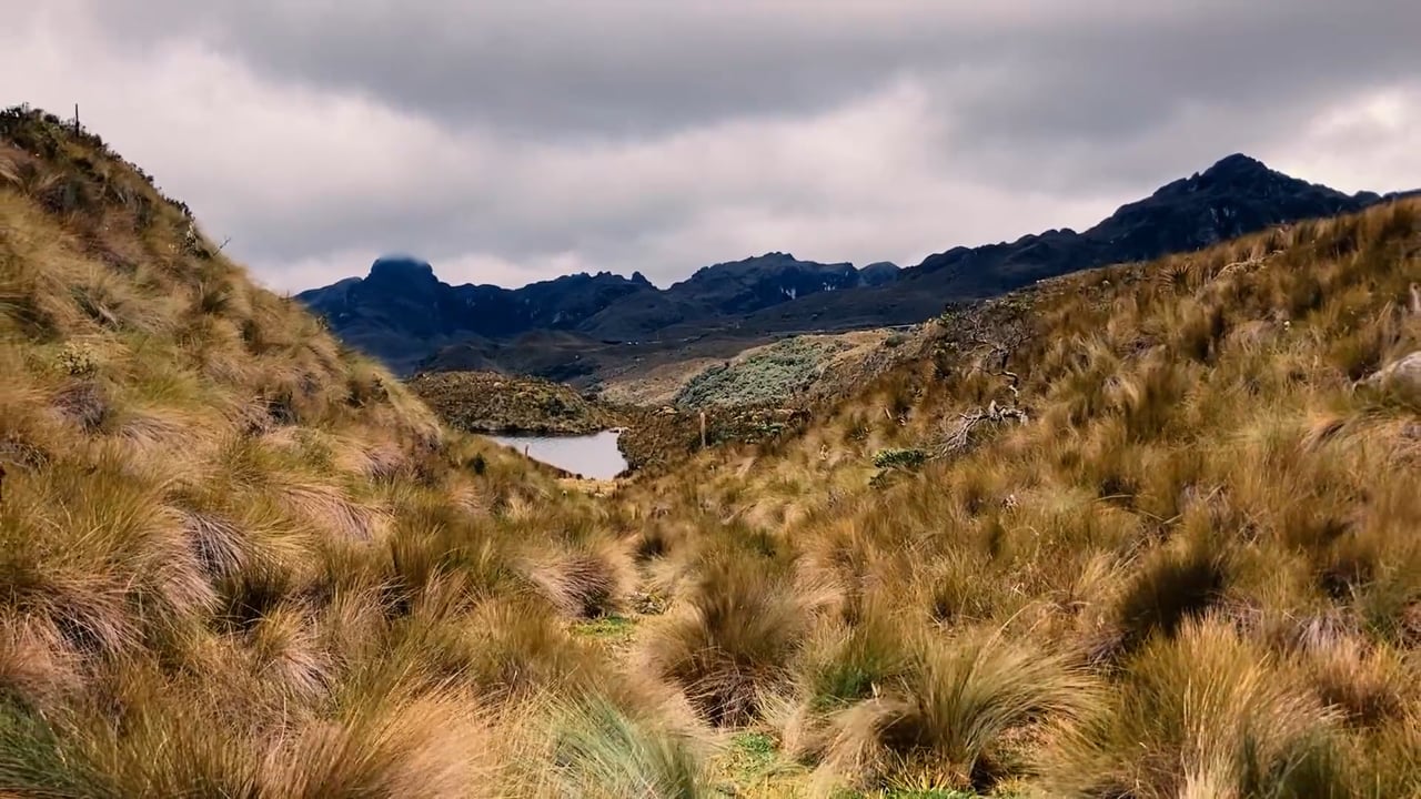
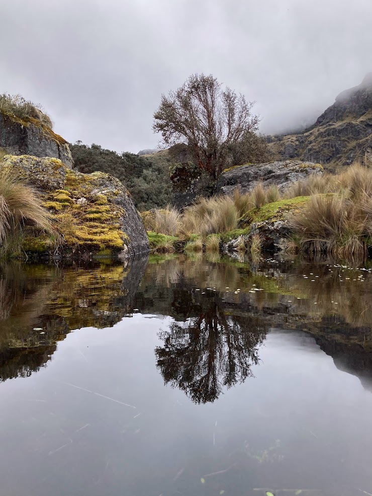
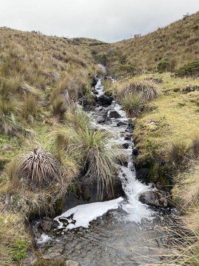
We experimented with counter-mapping as a tool to inform (re)design processes in the context of contestations around large-scale hydro-dam projects and rural-urban issues in the Yanuncay River and its páramos (Ecuador). The project uses notions from social construction of technology and counter-cartographies to better understand and theorize the role of ‘designs’ in the contestation and transformation of riverine spaces in which a multiplicity of actors try to create a specific social, technological and environmental order (a hydrosocial territory).
Drawing and mapping are research methods that can inform us about local territorial knowledge. Through a visual translation to an understandable language, they bring designers and academics closer to society and generate insights for design solutions.
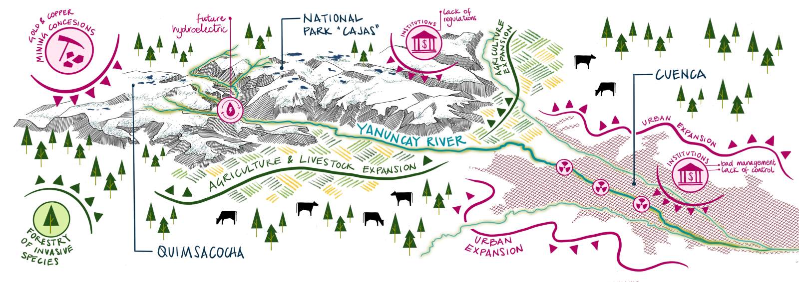
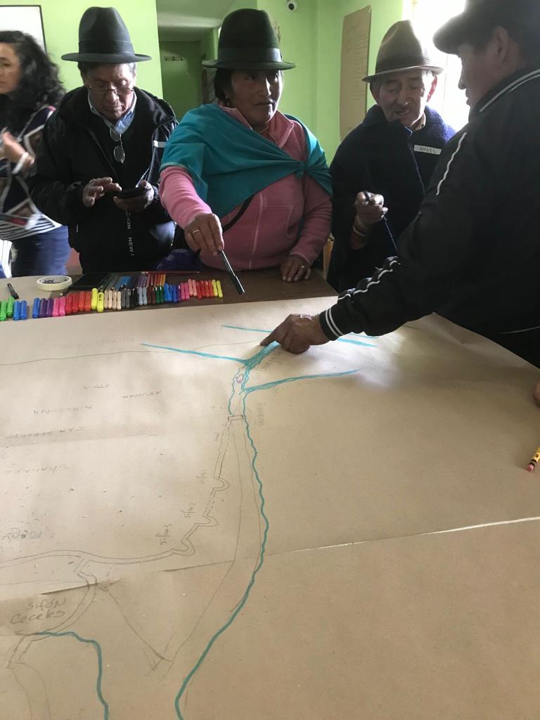
First exploration of counter-mapping with the Quimsacocha páramos and the Yanuncay river. The issues and problems were informed by the different actors that I engaged with and then I translated that information and knowledge into the visualization of this map.
Our objective was for the affected local communities to produce ‘mental maps’ of what they understand as their territory and their water struggles. The mapping exercise gathers the participants around a canvas where they are asked to draw and spatially locate ecopolitical relations, landscape interventions, and territorial transformations. During the process, they are guided through questions based on their perception and representation of socio-geographical components.
The resulting draft is then drawn in detail by the researcher for analysis and discussion in a collective session with the community. It can then be adjusted where necessary according to the participants’ perceptions and knowledge.
The opportunity of counter-maps as a design project also brings academics and professionals closer to the affected communities, creating links and bridges between different, world visions and understandings.
To a certain extent, it offers the opportunity to open the design process to the communities instead of being a closed process coming from hegemonic powers or professionals unaware of the socio-political context. Thus, in this project, we present a reflection on the use of counter-maps as a tool to convey grassroots ideas and how these visualizations can translate complex realities and information into an understandable language to generate design opportunities and bring knowledge back to society.
Share
Contacts
- -Catalina Rey-Hernándezcatalina.reyhernandez@wur.nl