Vasileios Milias
CTwalk Map is an excellent example of an AI-powered web tool which uses understandable methods, metrics, and visualizations to help users easily interact with the map. This challenges the notion that AI needs to be complex. Users discover how different open data sources can be combined, enabling them to critically assess the crucial role the completeness and quality of the data play in any AI tool.
With this new tool, urban planners and designers can shift from car-centric cities and embrace more human-centred models that encourage people to walk, explore, and connect with each other.
Examples can be found in Paris’s “15-minute-city”, Barcelona’s “superblocks”, or Hamburg’s “car-free zone”. However, existing approaches mainly rely on proximity-based metrics and lack more nuanced human-centred methods that capture “what can be considered accessible and for whom” and “how AI can help towards achieving this goal”.
CTwalk Mapprovides answers to these questions.
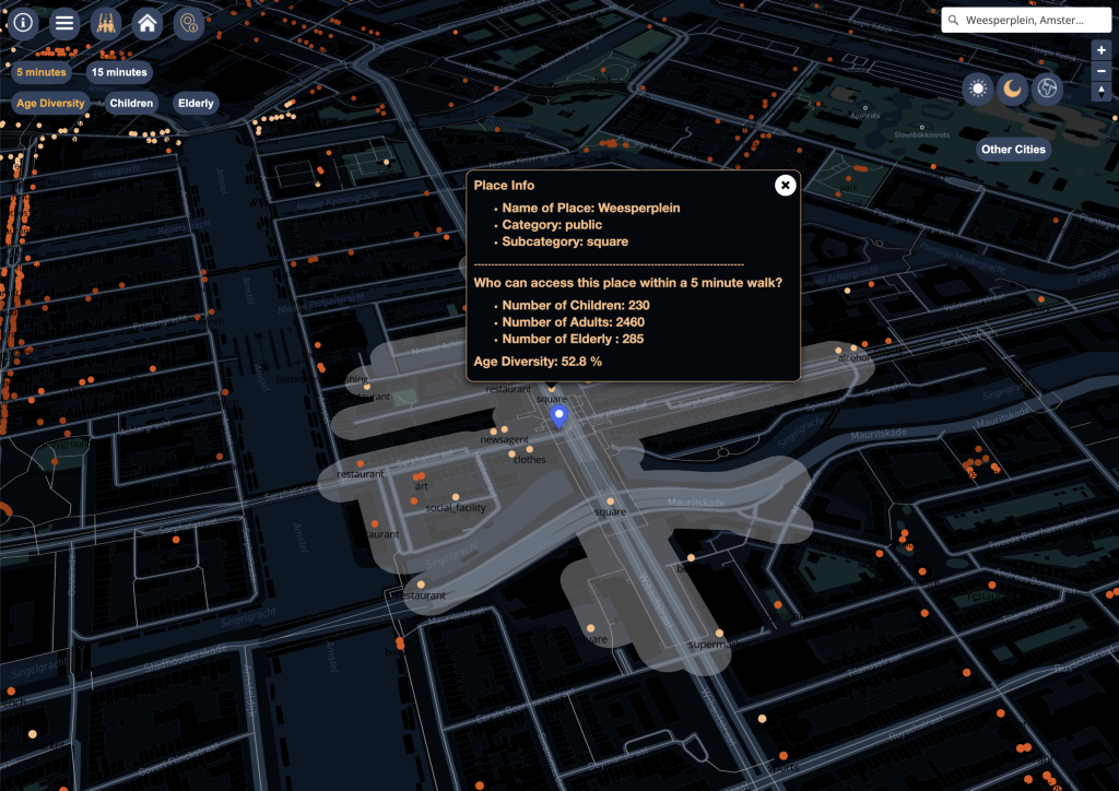
Is your neighbourhood park frequented by a homogenous or diverse mix of people? How many amenities can you reach within a short walking distance? And do you often encounter people from different walks of life?
As we witness the increasing availability of open data describing our urban environments, we can imagine tools that enable us to tackle these questions. But what does a tool like this actually look like?
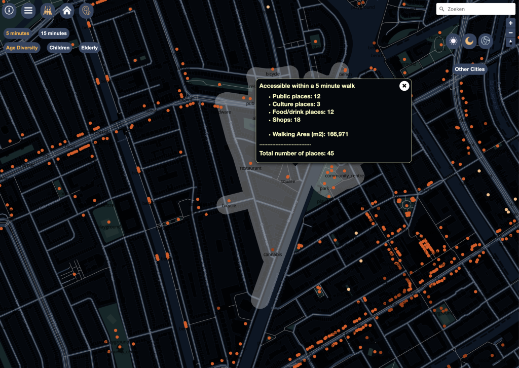
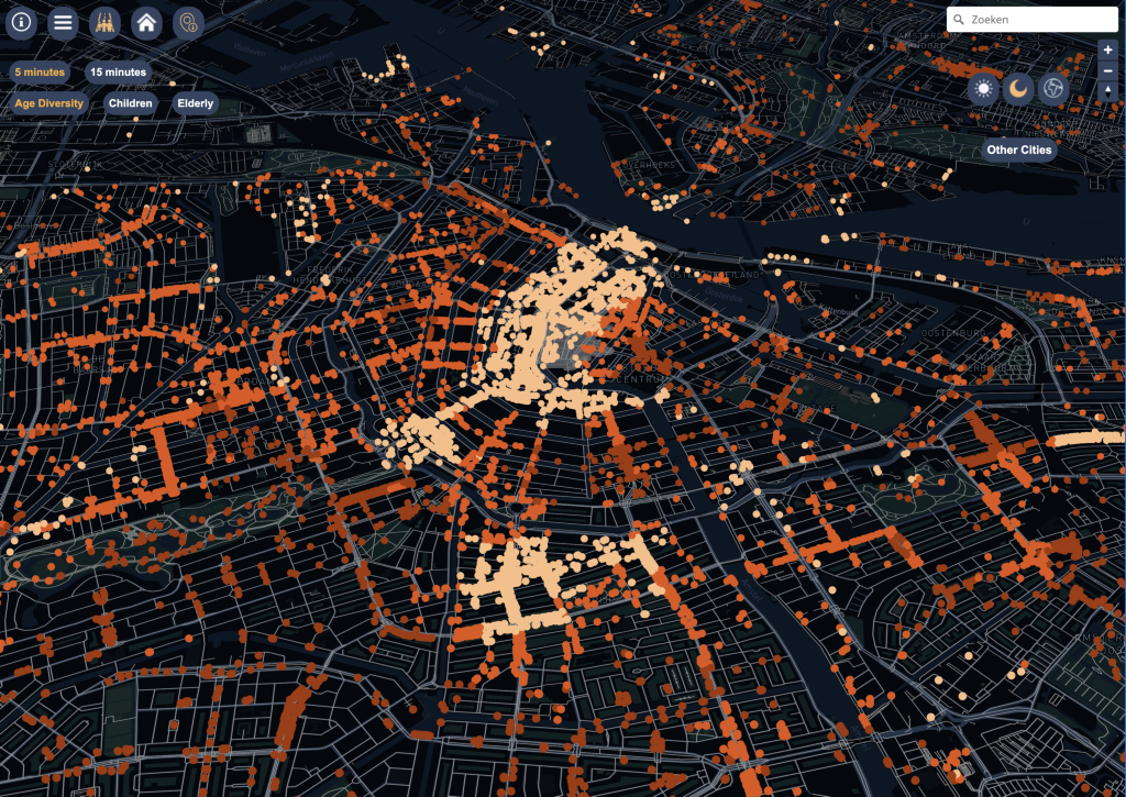
CTwalk Map is an AI-powered web tool designed to encourage social cohesion in urban neighbourhoods. It uses open source population, location, and pedestrian network data to estimate the number of individuals from different age groups who can reach city destinations within a 5 or 15-minute walk. It highlights opportunities for social cohesion and simplifies access inequities. A key feature is its transparency; it openly acknowledges data limitations, encouraging further data collection and refinement. With its user-friendly interface, users navigate the map and explore different destinations to identify anomalies and assess the completeness of the data sources. Furthermore, it helps citizens to understand the complex relationship between AI, urban design, accessibility, and social cohesion. They gain insights into how street networks shape accessibility, empowering them to engage in urban planning discussions.
In summary, CTwalk Map leverages AI to address societal challenges, exemplifying the potential of AI tools.
CTwalk Map is an excellent example of an AI-powered web tool that challenges the notion that AI needs to be complex. Users can interact with the map easily to discover how different open data sources can be combined, generating valuable insights into urban accessibility. It also invites users to adopt a critical mindset towards AI, highlighting the crucial role of data completeness and quality in any AI tool.